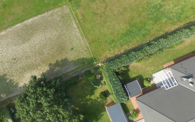
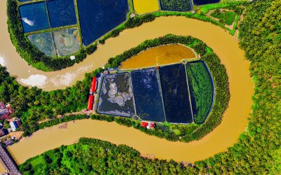
For centuries, boundary disputes have been a persistent source of contention among property owners, often leading to strained relationships, costly legal battles, and unresolved disagreements. However, the rapid advancements in aerial photography technology are revolutionising the way these disputes are resolved, paving the way for a future characterised by accuracy, efficiency, and amicable settlements.
Unveiling Boundaries with Unprecedented Precision
Traditional methods of boundary determination, relying on outdated maps, land surveys, and witness testimonies, have often proved inadequate in resolving disputes. Aerial photography, with its ability to capture high-resolution images of properties and their surroundings from an elevated vantage point, offers a game-changing solution.
Advancements in aerial camera technology have enabled the capture of images with unprecedented precision, providing surveyors with a wealth of detail that was previously unattainable. This clarity allows for the identification of even the most subtle boundary markers, such as changes in vegetation patterns, man-made structures, and subtle variations in terrain.
Revolutionising Boundary Determination with Advanced Tools
Aerial photography is not merely a tool for capturing images; it is an integral part of a sophisticated ecosystem of technologies that are transforming boundary dispute resolution. Advanced software applications allow surveyors to analyse aerial imagery with remarkable accuracy, automating the identification of boundary markers and generating detailed maps that overlay legal land title documents.
These advancements have significantly streamlined the boundary determination process, reducing the need for time-consuming and error-prone ground surveys. Surveyors can now rely on aerial imagery to quickly identify and map property lines, expediting the resolution of disputes and reducing costs for both parties involved.
Promoting Amicable Settlements through Neutral Evidence
Aerial photography, as an impartial and objective source of evidence, is fostering a more conducive environment for negotiations and mediations in boundary disputes. When presented with clear and unbiased visual representations of the disputed land, property owners are more likely to be open to compromise and seek mutually agreeable solutions.
Aerial imagery serves as a common ground upon which parties can build consensus. By providing a neutral perspective, it can help to break down communication barriers and foster a more collaborative approach to resolving disputes. This, in turn, promotes amicable settlements and reduces the likelihood of costly and protracted legal battles.
Shaping the Future of Boundary Dispute Resolution
As aerial photography technology continues to advance, its role in shaping the future of boundary dispute resolution is only expected to grow. With the potential for even higher resolution imagery, real-time data capture, and integration with artificial intelligence, aerial photography is poised to revolutionise the way boundary disputes are resolved.
These advancements will further enhance the accuracy, efficiency, and transparency of boundary determination, providing property owners with a more streamlined and amicable path to resolving disputes. Aerial photography is truly leading the way in shaping the future of boundary dispute resolution, ensuring a future where property lines are clear, conflicts are minimised, and amicable settlements become the norm.
Recent News & Articles
How Much Can Boundary Disputes Cost?
A boundary dispute is a disagreement between property owners or occupiers about the location of the boundary that separates their properties. Boundary disputes can arise for a number of reasons, including: Changes in property ownership: When a property is sold, the...
From Conflict to Conciliation: Aerial Photography Resolves Boundary Disputes in the UK
Boundary disputes, a persistent source of contention among property owners, have long plagued the UK landscape, leading to strained relationships, costly legal battles, and unresolved disagreements. With an estimated 6 million boundary disputes arising each year, the...
From Above, Disputes Disappear: Aerial Photography’s Role in Streamlining Boundary Dispute Resolution
For centuries, boundary disputes have been a persistent source of conflict, leading to strained relationships, costly legal battles, and unresolved disagreements. Traditional methods of boundary determination, relying on outdated maps, land surveys, and witness...


